Streamline BNG compliance with BNGAI™

Watch BNGAI™ in action
Accelerated BNG application review and fast validation
High-risk application flagging and monitoring
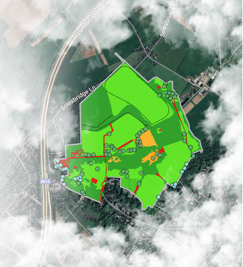
Satellite-powered land analysis for off-site credits
%20(1).png?width=400&height=273&name=OnePager-%20Event%20Handout%20-%20MultiDegment%20-%20Digital%20-%20Final%20(148%20x%20210%20mm)%20(1).png)
Validate with ease
BNGAI™ is an advanced platform that leverages AI and satellite imagery to simplify biodiversity net gain (BNG) compliance for local councils.
Designed to handle increasing application volumes, automate plan validation, and provide real-time insights, BNGAI™ empowers you to ensure accuracy, efficiency, and environmental sustainability across all your projects.
How BNGAI™ helps local governments
Simplify compliance with AI
and validate high volumes of BNG plans quickly and accurately
Identify high-risk projects
and prioritise detailed inspections to mitigate biodiversity risks
Develop biodiversity strategies
by conducting comprehensive ecosystem assessments effortlessly
Maximise land potential
through targeted biodiversity and accurate habitat enhancements
Improve road network biodiversity
by baselining and enhancing ecosystems along transport routes
Generate & manage biodiversity credits
by identifying and creating offsite habitat banks for developers
Safeguard the future
With tools to support local nature recovery strategies, habitat banking, and biodiversity improvements around road networks, BNGAI™ enables smarter, faster decisions that promote long-term ecosystem health.
BNGAI™ automates biodiversity plan checks, validates compliance, and flags high-risk projects needing closer scrutiny, helping local councils manage rising application volumes without sacrificing accuracy.
Conduct comprehensive ecosystem assessments to inform local nature recovery plans. BNGAI™ helps develop strategies for enhancing species recovery and ecosystem health.
Identify and manage habitat banks, create offsite BNG credits, and facilitate transactions between developers and councils to ensure compliance.
Baseline biodiversity and carbon along road networks and develop plans to enhance ecosystems surrounding transportation infrastructure.

BNG Masterclass for Local Planning Authorities
This detailed session covers everything from the fundamentals of BNG to the planning process.

BNG planning alert: New guidance on irreplaceable habitats
Getting permission to disrupt an irreplaceable habitat area will require time spent with your LPA...

Mastering BNG Trading and Habitat Banking
You may not realize all trading rules involved with delivering BNG

Defra Statutory Biodiversity Metric or Small Sites Metric: What’s your best approach?
Knowing which one to use is key to a compliant and sustainable development.
FAQs
BNGAI™ is an AI-powered platform that helps local councils and developers manage biodiversity net gain (BNG) compliance using satellite data and automated assessments.
Yes, BNGAI™ is powered by AI to manage multiple projects at once, providing real-time data and analysis to support efficient decision-making.
BNGAI™ enables accurate baseline assessments, habitat classification, and continuous monitoring to ensure effective biodiversity management.
BNGAI™ simplifies the review and validation of BNG plans, identifies at-risk projects, and supports the creation of local biodiversity plans and off-site BNG credits.
Start the change
Redeem your gift certificate now and start transforming the biodiversity management in your region.


